Wildfire Technology Investment in 2026: Why Detection and Prevention Lead, and Suppression Lags
Detection and prevention lead wildfire tech investment, from FireSat to Pano AI. Suppression autonomy still lags. A 2026 investor's guide.

Summary
The investable core of wildfire technology as of the 2026 fire season is detection and prevention analytics, not suppression: the companies generating real recurring revenue today sell early-detection intelligence (camera networks, dedicated thermal satellites, gas sensors) and utility-facing risk analytics, while autonomous aerial suppression remains at the demonstration stage and is currently speculative. Pano AI, a private AI-camera detection company, reports contracted revenue exceeding $100 million after four consecutive years of growth, and Technosylva's utility risk-modeling platform is embedded in the daily operations of the largest western US utilities; these are the clearest evidence that buyers will pay for wildfire intelligence at scale [1][2].
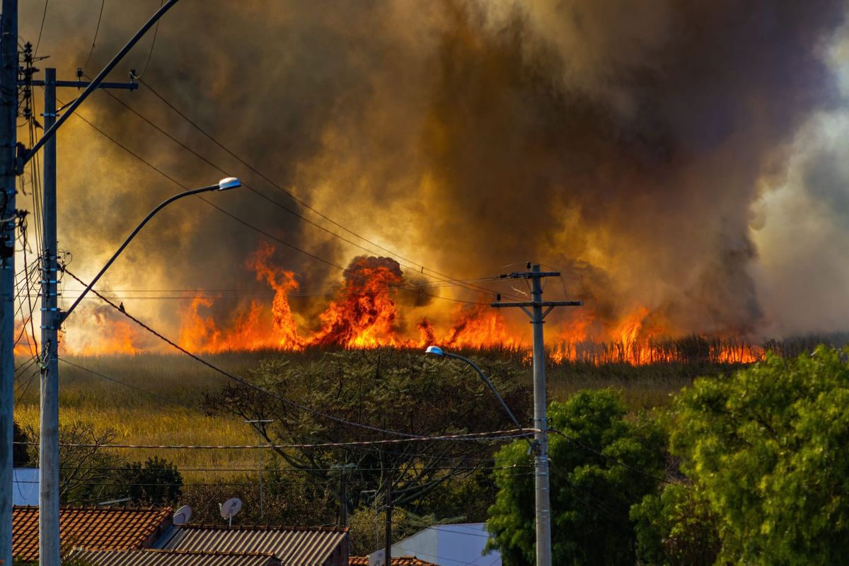
The demand shock from the January 2025 Los Angeles fires has durably expanded procurement appetite among the three buyer classes that actually hold budget: electric utilities under strict-liability pressure, insurers repricing catastrophe risk, and state fire agencies. Munich Re, a German insurance company, calculated the disaster at $53 billion in total losses, of which $40 billion was insured, and Aon's Q1 2025 catastrophe report attributed roughly 71% of global insured disaster costs that quarter to the Palisades and Eaton fires; the United Nations Office for Disaster Risk Reduction cites independent estimates placing total economic damage between $250 billion and $275 billion [3][4][5]. This is the single most important shift in the field since the prior baseline.
The central risk to detection-layer economics is commoditization by free government data: NASA's FIRMS delivers VIIRS and MODIS active-fire detections at no cost, and any commercial detection business must defensibly beat that baseline on latency, minimum detectable fire size, and false-alarm rate to justify price [6]. Purpose-built constellations (FireSat, OroraTech) and ground-truth camera and sensor networks are the credible ways to do so [7][8].
For the investor, the highest-conviction exposure is in detection intelligence and utility- and insurer-facing prevention analytics with recurring-revenue models and demonstrated contracts; suppression autonomy and IoT-triggered drone response merit small, staged, milestone-gated positions because their claims remain largely unvalidated by third parties.
Wildfire Technology: The Investment Case Across Detection, Prevention, and Suppression (2026)
1. Background: The Physical and Market Problem
Wildfire value creation is governed by a simple physical asymmetry: the cost of suppressing and recovering from a fire rises super-linearly with the size the fire reaches before effective response, so the economic return to earlier detection and to reducing available fuel is very large. The Earth Fire Alliance's modeling of its FireSat system projects that in the United States alone even a one-hour satellite revisit rate could save more than $1 billion annually in fire damage costs, protect 3,500 homes and properties, and reduce burned land by 1.3 million acres; these are developer projections, not realized results, but they capture the shape of the value curve [7]. Rain, an autonomous-aircraft developer, cites Gordon and Betty Moore Foundation research finding that a 15-minute reduction in response time could reduce the frequency of large uncontained wildfires by three to seven percent, translating to $3.5 billion to $8.2 billion in economic benefits and $150 million to $350 million in fiscal benefits in California [9].
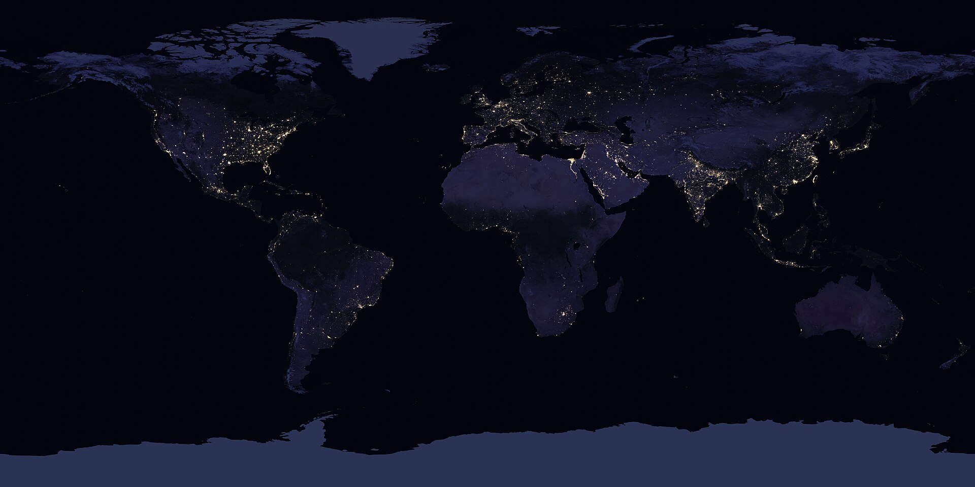
The detection problem has a well-characterized technical structure. Legacy government spaceborne assets trade resolution against revisit. NASA's MODIS instruments (launched 1999 and 2002) detect fires at roughly 1-kilometer resolution; the newer VIIRS instruments aboard Suomi-NPP, NOAA-20, and NOAA-21 improved this to 375 meters but still revisit a given location only about twice a day, leaving a multi-hour gap through the afternoon peak burn period and delivering data typically three or more hours after overpass [6][10]. Geostationary assets such as GOES ABI offer near-continuous refresh but coarse spatial resolution. The commercial thesis for dedicated constellations is precisely to collapse both the latency and the minimum detectable fire size simultaneously.
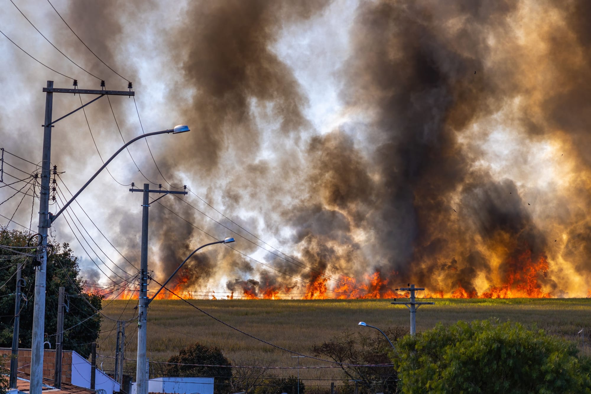
The January 2025 Los Angeles firestorm reset the market's baseline expectations. FireRescue1's anniversary tally records 31 deaths and 16,246 structures destroyed across 59 square miles, making the event the costliest wildfire in US history [4][5]. Crucially, the fires occurred in January, outside the historical fire season, in a high-net-worth wildland-urban interface, which is why insured losses were so severe and why they hardened the resolve of insurers, reinsurers, and utilities to fund mitigation and detection technology.
2. Key Players and Stakeholders
2.1 Detection: dedicated satellites
The most-watched entrant is FireSat, led by the nonprofit Earth Fire Alliance with satellites built and operated by Muon Space and sensor and AI development contributions from Google Research; Google.org contributed $13 million toward development [7][11]. The FireSat Protoflight launched on SpaceX's (NASDAQ:SPCX) Transporter-13 mission on March 14, 2025, and over its first year collected more than one million multispectral infrared images, including detection of a small roadside fire in Oregon that other space-based systems observing the region did not detect [11][12]. On July 7, 2026, Muon Space announced the launch of the first three operational satellites aboard SpaceX's Transporter-17, marking the transition from single-demonstrator to operational constellation [11]. The design target is detection of fires as small as 5 by 5 meters with a 20-minute revisit once the full 50-plus satellite constellation is operational, targeted for the early 2030s; the program aims to provide hourly imagery anywhere by 2029 [7][12]. Early-adopter fire agencies in California, Colorado, Australia, and Portugal are slated to begin using the data [12]. Muon Space is a private company and has also won a US Space Force prototype weather-satellite contract, expressing dual-use revenue [13].


OroraTech, a Munich-based company, operates the competing dedicated thermal constellation. Its OTC-P1 batch of eight 8U CubeSats launched on a dedicated Rocket Lab (NYSE:RKLB) Electron mission on March 27, 2025, built on Spire Global's satellite platform [8]. OroraTech has raised a Series B extended to €37 million (backed by BNP Paribas Solar Impulse Venture Fund and Rabo Ventures) and describes an operational constellation of ten thermal-sensing satellites serving customers in Australia, Europe, and the Americas, with a longer-term ambition of a 100-satellite constellation and a per-satellite detection resolution reported at roughly 4 by 4 meters [8][14][15]. It also won a €20 million contract from the Greek government and ESA for four dedicated wildfire nanosatellites and, with Spire, a NASA contract [16].
Planet Labs PBC (NYSE:PL) is the most relevant public pure-play in commercial Earth observation. It is not a dedicated fire-detection operator but provides daily multispectral imagery used in forestry, vegetation, and infrastructure monitoring; the stock traded near $22 in mid-July 2026 with a market capitalization around $8 billion, FY2026 revenue of $307.7 million, and FY2027 revenue guidance of $415 million to $440 million against a backlog exceeding $900 million [17][18].
 Josh Dinner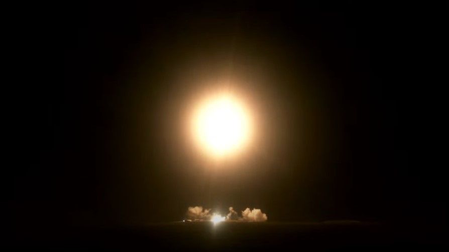
2.2 Detection: ground camera networks and IoT sensors
Pano AI, private and San Francisco-based, is the commercial leader in AI-camera detection. It closed a $44 million Series B in June 2025 led by Giant Ventures with participation from Liberty Mutual Strategic Ventures and Tokio Marine Future Fund, bringing total funding to $89 million; it reports contracted revenue exceeding $100 million supporting coverage of nearly 30 million acres, serving more than 250 first-responder agencies and roughly 15 major utilities including Arizona Public Service, Portland General Electric, and Xcel Energy [1][19]. The participation of two insurer venture arms is a meaningful signal of buyer-side pull.
ALERTCalifornia, operated by the University of California San Diego, is the dominant public-sector camera network: more than 1,200 AI-enabled cameras (built with Axis Communications and DigitalPath's AI) that in 2025 alerted CAL FIRE to approximately 3,600 fire incidents, in many cases before 911 calls [20][21]. From 2019 to 2024 CAL FIRE contributed at least $24 million to expanding the system [20]. Its existence as a state-funded, free-to-agencies utility is both a validation of the camera approach and a competitive constraint on commercial camera vendors in California.
Dryad Networks, Berlin-based, is the leading distributed IoT play. Its Silvanet system uses solar-powered, supercapacitor-based gas sensors (detecting hydrogen, carbon monoxide, and volatile organic compounds) on a LoRaWAN mesh to detect smoldering fires before open flame, with sensors priced around €48, mesh gateways around €371, and border gateways around €549 [22][23]. It has raised roughly €22 million ($24 million) to date and targets break-even in 2026 [24]. In a documented Lebanon deployment, Silvanet detected an unauthorized fire within roughly 30 minutes [23].
 German N., Head of Forest Fire Protection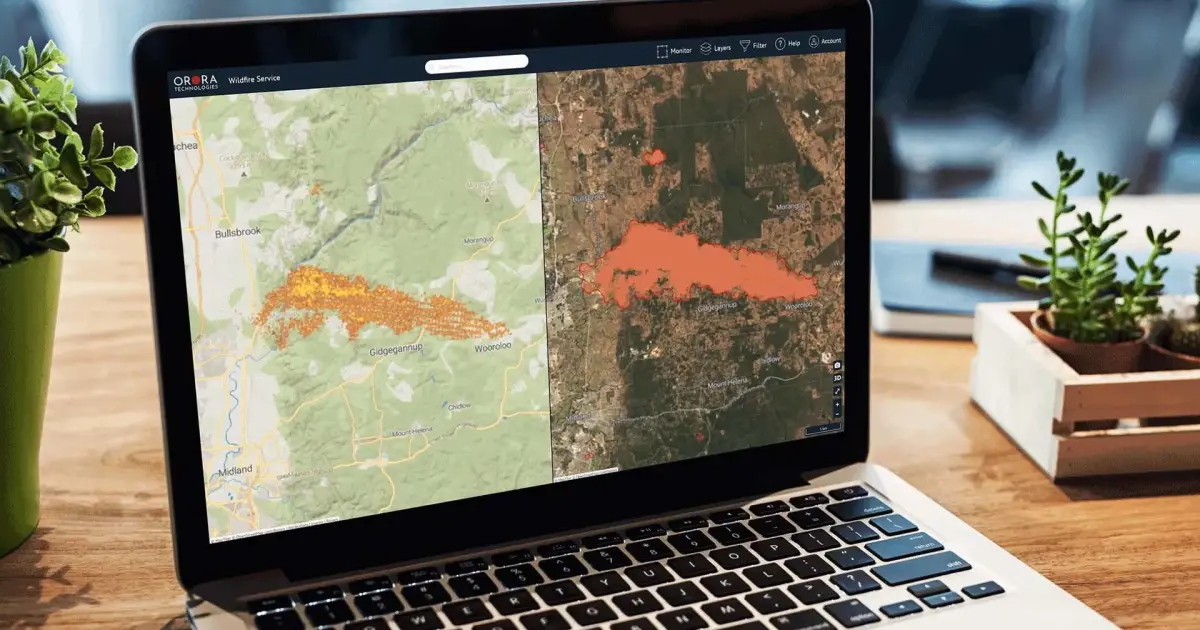
2.3 Prevention: vegetation analytics, utility hardening, and mechanical fuel reduction
Technosylva, founded 1997 and majority-backed by growth-equity firm TA Associates since 2022, is the incumbent in utility and agency wildfire risk modeling; its Wildfire Analyst and fiResponse platforms are used by CAL FIRE and investor-owned utilities including PG&E, Southern California Edison, San Diego Gas & Electric, PacifiCorp, and Xcel Energy across 15-plus states [2][25]. PG&E credits its layered mitigation, which uses Technosylva modeling, with a 68% reduction in reportable ignitions on primary distribution conductors and a 99% reduction in acres impacted in 2022 versus baseline [26].
Overstory (Amsterdam and Boston) sells satellite-plus-AI vegetation intelligence to electric utilities; it announced a $43 million Series B on November 25, 2025, led by Blume Equity with Energy Impact Partners, bringing total funding to approximately $67.8 million, and serves more than 50 utilities including several of the ten largest in the Americas [27]. Vibrant Planet sells "Land Tender," a SaaS forest-planning and fuel-management platform, primarily to federal and state land managers; its last-named priced round was a $15 million Series A in October 2023 led by Ecosystem Integrity Fund, with total raised reported between $34 million and roughly $45 million across subsequent extensions [28].
On the utility grid-ignition-risk side, PG&E Corporation (NYSE:PCG) and Edison International (NYSE:EIX) are the archetypal buyers, both operating under California's inverse-condemnation strict-liability regime that pushed PG&E into bankruptcy after the 2018 Camp Fire [4][5]. Gridware, private, sells pole-mounted "Gridscope" sensors for continuous grid monitoring; it raised a $55 million Series B led by Tiger Global and Generation Investment Management (following a $26.4 million Series A led by Sequoia) and monitors grid infrastructure for PG&E and roughly 18 customers across about 10,000 poles [29][30]. A 2026 study by a scientist at the UC Berkeley Haas School of Business across PG&E's 80 riskiest circuits (more than 5,000 miles) found its Active Grid Response drove a median 16% reduction in outage duration per protection zone [30].
Mechanical and robotic fuel reduction is led by BurnBot, which raised a $20 million Series A in April 2024 (led by ReGen Ventures, with insurer venture arm AmFam Ventures among others), operating remote-operated masticators / mechanical grinders and its RX mechanized prescribed-fire system for customers including PG&E [31][32]. Kodama Systems (Sonora, California) retrofits forestry machinery for teleoperation and supervised autonomy; it has raised approximately $13.6 million total, including a $6.6 million seed (Breakthrough Energy Ventures, Congruent Ventures) and a reported roughly $7 million Series A in October 2025 [33]. Drone Amplified's IGNIS is the only UAS-based aerial-ignition payload approved for US federal prescribed fires and wildfires, dropping potassium-permanganate ignition spheres from drones to conduct backburns, and is a fielded, revenue-generating product [34].
 John D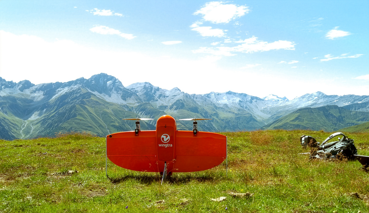
2.4 Suppression: autonomous and optionally piloted aircraft
Rain, private and Alameda-based, develops wildfire mission-autonomy software that adapts existing autonomous aircraft to perceive and suppress fires; it has raised roughly $9.7 million to $14.7 million (a 2023 seed of $9.7 million led by DBL Partners) [9][35]. With Sikorsky, a unit of Lockheed Martin, Rain demonstrated an autonomous Black Hawk executing water drops on test fires in Connecticut in October 2024 and in representative Southern California wildfire terrain in late April 2025, flying 24 hours over two weeks at 3,300-foot altitude in gusts to 30 knots, with safety pilots aboard but hands-off [36][37]. Sikorsky's underlying MATRIX autonomy also received a $6 million DARPA contract to be installed on a US Army Black Hawk [37]. These are demonstrations, not fielded operational systems.
Dryad Networks is building "Silvaguard," an autonomous suppression drone, funded partly by a €3.8 million European Regional Development Fund grant; in a March 2025 demonstration in Germany a Silvaguard drone autonomously navigated to a sensor-detected fire and provided aerial observation, with actual suppression (via acoustic or other methods) still an aspiration [38][23].
2.5 Defense-adjacent primes and satellite communications
Among public defense-adjacent names, Lockheed Martin (NYSE:LMT) has the most direct, material wildfire exposure through Sikorsky autonomy and its Firehawk and LM-100J FireHerc firefighting aircraft [36]. AeroVironment (NASDAQ:AVAV), Kratos Defense (NASDAQ:KTOS), RTX (NYSE:RTX), and L3Harris (NYSE:LHX) are adjacent suppliers of uncrewed systems and sensors, but none has disclosed wildfire-specific revenue material to the investment view; they should be treated as optionality, not thesis. Iridium (acquired by Rocket Lab) and other satellite-communications providers are relevant as connectivity enablers (Dryad, for example, uses satellite backhaul), but wildfire is not a significant revenue line for them.
3. Technical and Operational Considerations
Detection value is decided by five measurable metrics: time to detection, minimum detectable fire size, revisit interval, night and cloud/smoke performance, and false-alarm rate. No single layer optimizes all five, which is why the operations are a layered architecture rather than a winner-take-all platform.
Legacy government satellites offer global coverage at zero marginal cost but are sub-optimal on latency and resolution: VIIRS at 375 meters and roughly twice-daily revisit with multi-hour data latency means a fire can grow to thousands of acres before it registers [6][10]. Dedicated constellations attack exactly this gap. FireSat's 5-by-5-meter design target represents a roughly two-order-of-magnitude improvement in minimum detectable fire size over MODIS, and its Google Research AI compares each observation against a large history of prior images of the same location to suppress false positives from industrial flares, hot rooftops, and sun glint [7][12]. The critical epistemic caveat is that the 20-minute global revisit is contingent on completing the 50-plus satellite constellation in the early 2030s; the three operational satellites launched in July 2026 deliver roughly twice-daily observation, materially better than legacy assets on resolution but not yet on revisit [11][12]. Thermal infrared (used by both FireSat and OroraTech) penetrates smoke and works at night, which is a decisive advantage over visible-spectrum optical systems during active fire behavior [8].
Ground camera networks occupy a different point on the tradeoff surface: very low latency and high spatial precision within line of sight, strong triangulation of position, and continuous day/night coverage using near-infrared, but coverage limited to camera viewsheds (Pano and ALERTCalifornia cameras see roughly 60 miles by day and up to 120 miles at night from a given site) and vulnerability to terrain occlusion and to false positives from dust and cloud [1][20][21]. The false-alarm problem directly drives the alert-fatigue risk: ALERTCalifornia's AI, developed by DigitalPath, still cannot always distinguish smoke from dust or cloud, which is why human-in-the-loop verification remains standard [20].
IoT gas sensing (Dryad) offers the earliest possible detection, at the smoldering phase before open flame, and works sub-canopy where optical and thermal systems are blind, but only within roughly 100 meters of a sensor in high-risk deployments, making it an economically bounded solution for high-value assets and defined perimeters rather than for landscape-scale monitoring [22][23]. The three layers are therefore complementary: satellites for breadth, cameras for verified line-of-sight coverage of populated interface zones, and sensors for pinpoint early warning around critical infrastructure.
Prevention analytics operate on a longer time horizon and a cleaner business model. Technosylva, Overstory, and Vibrant Planet all sell software-as-a-service that ingests fuel, vegetation, weather, terrain, and asset data to model ignition probability and fire spread days in advance, letting utilities target vegetation management, undergrounding, and public-safety power shutoffs surgically rather than indiscriminately [2][25][27]. The moat here is proprietary data and validated models: Technosylva's roughly three decades of fire data is a barrier that newly funded entrants cannot quickly replicate [2]. Mechanical fuel reduction (BurnBot, Kodama) and drone aerial ignition (Drone Amplified) are labor-productivity plays: BurnBot claims its RX lets small crews treat areas up to ten times faster, and IGNIS removes ground crews from the most hazardous ignition tasks [31][34].
Suppression autonomy is the least mature layer. The Rain-Sikorsky demonstrations are technically impressive, but they remain supervised demonstrations over test fires and small brush piles with safety pilots aboard, not autonomous operational suppression of uncontrolled wildfires [36][37]. Drone-swarm suppression, including Dryad's Silvaguard, is at prototype or research stage, with the actual extinguishing mechanism unproven at any operationally relevant scale [38]. The physics is unforgiving: meaningful water or retardant payloads require large aircraft, and the airspace-deconfliction problem (Section 5) is severe.
4. Economic and Market Dynamics
The wildfire-technology market is growing but must be sized carefully because vendor market-sizing reports are promotional. Independent funding data show the sector maturing toward fewer, larger rounds since 2023, with forecasting and monitoring overtaking vegetation management as the leading segment for investment in 2025, and Europe (particularly Germany) and North America as the leading destinations [39]. Convective Capital, a venture firm dedicated to wildfire founded by former WePay chief executive Bill Clerico, closed a $35 million debut fund in 2022 and has backed Gridware, Rain, Overstory, and BurnBot; in 2026 it closed an $85 million Fund II, backed by John and Patrick Collison, the Arbor Day Foundation, StepStone Group, and two insurance companies, evidencing a deepening specialist-investor thesis [40].
The clearest revenue evidence sits in detection and prevention. Pano AI's contracted revenue exceeds $100 million, a figure that distinguishes it sharply from pre-revenue peers, and its Series B was supported by four years of triple-digit growth [1][19]. Technosylva's utility segment is now its largest and has grown rapidly as wildfire shifted from a "California problem" to an industry problem after the 2021 Marshall Fire and 2023 Lahaina fire [2]. The buyer base is dominated by entities with larger budgets and liability exposure: electric utilities (PG&E alone spends more than $1 billion annually on vegetation management), state fire agencies, and insurers, the last of which are entering via corporate venture arms (Liberty Mutual, Tokio Marine, AmFam) [1][31][41].
The demand catalyst is the repricing of catastrophe risk after January 2025. The LA fires consumed a large share of major European reinsurers' 2025 catastrophe budgets, and rating agencies expect California homeowner insurance to become substantially more costly, which strengthens the willingness of insurers and utilities to pay for mitigation that demonstrably reduces expected loss [3][4]. Government funding is a double-edged driver: the Bipartisan Infrastructure Law provided a historic $3.5 billion investment in wildfire management, and combined BIL and Inflation Reduction Act climate resilience and adaptation investment has been cited at roughly $50 billion, but grant-dependent revenue remains exposed to budget cycles [40].
5. Regulatory Landscape
Regulation is important to this thesis and earns a dedicated section because it directly gates the suppression and drone-detection layers. The single most consequential fact is that unauthorized drone incursions ground firefighting aircraft: when a non-participating drone enters a wildfire Temporary Flight Restriction, fire managers must halt all aerial operations for safety. During the January 2025 LA fires a civilian DJI drone punched a hole in the wing of a Super Scooper firefighting aircraft over the Palisades Fire, grounding it, and the US Forest Service recorded 218 drone incursions over active wildfires in 2025, 184 of them during the Eaton and Palisades fires [42][43]. This is the paradox the suppression-autonomy thesis must resolve: the same airspace that developers want to fill with autonomous firefighting aircraft is one where a single stray drone shuts down operations.
The enabling regulatory pathway is the FAA's proposed Part 108 rule for beyond-visual-line-of-sight operations, published as a Notice of Proposed Rulemaking on August 7, 2025, which would replace the case-by-case Part 107 waiver system with a standardized, performance-based framework for drones up to 1,320 pounds [44][45]. A final rule is expected around spring 2026 under an executive-order timeline, with implementation likely 6 to 12 months later; the FAA reopened the comment period in January 2026 specifically on electronic-conspicuity and right-of-way provisions after manned-aviation stakeholders (including aerial-firefighting interests) objected that giving BVLOS drones presumptive right-of-way over manned aircraft creates a "one-way visibility gap" and collision risk for low-altitude helicopter operations [45][46]. The certification pathway for autonomous firefighting aircraft therefore remains unsettled, and this regulatory uncertainty is a primary reason suppression autonomy cannot be underwritten as a near-term operational business. The detection and prevention layers are largely insulated from this constraint because satellites, fixed cameras, and ground sensors do not require BVLOS authority.
6. Material Risks
The commoditization risk from free government data is the most fundamental threat to detection-layer economics, and its likelihood is high because NASA FIRMS already distributes VIIRS and MODIS active-fire data globally at no cost with no API key [6]. Its impact is concentrated on undifferentiated satellite-detection offerings; the credible mitigation, already demonstrated, is to beat the free baseline decisively on the metrics that matter, which is exactly what FireSat's 5-meter resolution and OroraTech's thermal night-and-smoke performance are designed to do, and what Pano's low-latency line-of-sight verification and Dryad's smoldering-phase detection deliver in domains the satellites cannot address [7][8][1][22].
Detection precision and alert fatigue is a moderate-likelihood, high-impact operational risk: false positives from dust, cloud, and industrial heat sources erode agency trust and can cause real alerts to be ignored [20]. Mitigation is advancing through AI classification trained on large labeled fire datasets and through human-in-the-loop verification, but no vendor has eliminated false positives, and claims of near-zero false-alarm rates should be treated skeptically absent third-party validation.
Funding and procurement dependence on government budget cycles is a high-likelihood, moderate-impact risk given that fire agencies and grant programs are major buyers and that the multi-year federal appropriations are finite and politically contingent [40]. The mitigation that de-risks a given company is diversification into utility and insurance buyers, who have their own liability-driven budgets; Pano (utilities plus insurers), Technosylva (utilities), and Overstory (utilities) are comparatively insulated, while pure agency-dependent vendors are more exposed.
The suppression-autonomy maturity gap is a near-certain, high-impact risk to any thesis that prices in operational autonomous suppression before roughly 2030. Demonstrations remain supervised and small-scale, the regulatory pathway is unresolved, and the airspace-deconfliction problem is severe [36][37][45]. The mitigation for investors is to size suppression positions as milestone-gated options rather than core holdings, with clear triggers (Part 108 finalization, an uncrewed operational suppression deployment, a paying agency contract) that would justify adding.
Physical limits are permanent, moderate-impact constraints that bound what any layer can achieve: satellite revisit gaps persist until constellations are complete, cloud and dense smoke degrade optical performance (though thermal infrared mitigates this), and night operations remain harder for crewed aircraft [8][12]. These limits are the technical reason the layered architecture, rather than any single platform, is an ideal framing for the whole field.
7. Implications for the Investor
The highest-conviction, nearest-term exposure is detection intelligence and utility- and insurer-facing prevention analytics with recurring-revenue models and demonstrated contracts. In private markets, Pano AI is the standout on revenue evidence ($100 million-plus contracted, insurer-backed), and Technosylva and Overstory are the strongest prevention-analytics franchises by virtue of embedded utility relationships and, for Technosylva, an irreproducible three-decade data moat [1][2][27]. The staged approach is to concentrate here first, because these are the businesses where buyers are already paying at scale and where the January 2025 demand shock most directly converts into contracts.
In public markets, Planet Labs (NYSE:PL) is the most liquid way to gain adjacent exposure to the Earth-observation data layer, though it is a diversified geospatial business rather than a wildfire pure-play, and its recent share-price appreciation warrants attention to valuation; the benchmark that would justify adding is continued backlog conversion and defense-plus-commercial revenue growth toward its $415 million to $440 million FY2027 guidance [17][18]. Lockheed Martin (NYSE:LMT) offers indirect suppression-autonomy optionality through Sikorsky, but wildfire is immaterial to its consolidated financials and should not be bought as a wildfire thesis. AeroVironment, Kratos, RTX, L3Harris, and Iridium do not currently offer wildfire-specific exposure.
Suppression autonomy (Rain, and the suppression ambitions of Dryad) and IoT-triggered drone response merit small, milestone-gated positions only. The concrete triggers that would justify increasing exposure are: finalization of FAA Part 108 with a workable path for firefighting-aircraft deconfliction; a first uncrewed (no safety pilot) operational suppression of an actual wildfire; and a paying, multi-year agency or utility contract for autonomous suppression. Absent those, the layer is a research option, not a business, and should be sized accordingly.
Across the portfolio, the benchmarks that should change the allocation are straightforward. Positive signals to add: FireSat and OroraTech publishing third-party-validated detection latency and minimum-fire-size performance in operation (not modeled); detection vendors demonstrating durable pricing power over free FIRMS data through renewals and net revenue retention; and insurers formally crediting specific technologies in underwriting, which would convert mitigation from cost to revenue driver. Negative signals to trim: evidence of alert-fatigue-driven churn, commoditization compressing detection pricing, or grant-cycle reversals cutting agency budgets. The governing discipline is to pay for demonstrated recurring revenue and technical advantage, and to treat every suppression and swarm claim as unproven until a named third party or a paying customer validates it.
 John D
 John D

 John D
 John D
 John D
References
[1] Pano AI / GlobeNewswire. 2025. "Wildfire Tech Comes of Age: Pano AI Raises $44M Series B." June 16.
[2] Latitude Media. 2024. "In a crowded market, firetech veteran Technosylva is betting on utilities."
[3] Aon. 2025. "Q1 2025 Global Catastrophe Recap"; UNDRR. 2025. "The invisible costs of wildfire disasters in 2025."
[4] Moody's. 2025. "LA Wildfires: Implications for Casualty Insurers"; Munich Re (via UNDRR). 2025.
[5] Milliman. 2025. "Industry insured losses for Los Angeles wildfires"; FireRescue1. 2026. LA fires anniversary tally.
[6] NASA FIRMS / Earthdata. "Fire Information for Resource Management System."
[7] Earth Fire Alliance. 2025. "First Wildfire Images from FireSat Protoflight."
[8] eoPortal. "OroraTech Wildfire Constellation."
[9] Rain / Business Wire. 2023. "Rain Announces $9.7M in Seed Financing"; Gordon and Betty Moore Foundation. "The economic, fiscal, and environmental costs of wildfires in California."
[10] EFFIS (Copernicus). "Active Fire Detection."
[11] Muon Space / GlobeNewswire. 2026. "Muon Space Deploys First Three Operational FireSat Satellites." July 7.
[12] Google Research. "FireSat - Wildfires"; Heatmap News. 2026. "The Satellites Hunting Wildfires in Real Time."
[13] Breaking Defense. 2025. "Space Force taps Muon for 3 prototype weather satellites."
[14] Space Insider. 2025. "Wildfire Satellite Company OroraTech Extends Series B Funding Round to €37 Million." May 15.
[15] arXiv. 2026. "Automating the Wildfire Detection and Scheduling Pipeline with Maneuverable Earth Observation Satellites."
[16] eoPortal. "Greek National Small Satellite Programme (GNSSP)."
[17] PitchBook. 2026. "Planet Labs Company Profile."
[18] Kavout / Simply Wall St. 2026. Planet Labs FY2026 results and FY2027 guidance.
[19] Enlit World. 2025. "AI-powered wildfire detection startup Pano AI raises another $44m."
[20] Bay Area News Group / FireRescue1. 2025. "ALERTCalifornia AI wildfire camera network."
[21] Axis Communications / Business Wire. 2026. "Statewide Camera Network and AI Advance Early Wildfire Detection." June 23.
[22] The ST Blog. "Silvanet: an STM32WL can live 15 years outdoors."
[23] Business Wire. 2025. "Dryad Networks Demonstrates First Fully Functional Drone Prototype." March 26.
[24] Light Reading. 2025. "Dryad Networks connects the forests for early wildfire detection."
[25] Technosylva / Business Wire. 2022. "Technosylva welcomes strategic growth investment from TA."
[26] Technosylva. "How PG&E Performs Wildfire Risk Mitigation."
[27] PR Newswire. 2025. "Overstory $43M Series B funding." November 25.
[28] TechCrunch. 2023. "Vibrant Planet raises $15 million Series A." October 5.
[29] Business Wire. Gridware Series B ($55 million) and Series A ($26.4 million).
[30] Gridware / Business Wire. 2026. "Gridware Study Finds Active Grid Response Technology Improves Power Reliability." February 4.
[31] PR Newswire. 2024. "BurnBot Secures $20M in Series A Funding." April 2.
[32] CNBC. 2024. "As California wildfire season nears, startup BurnBot."
[33] PitchBook / Tracxn / PR Newswire. Kodama Systems funding.
[34] International Fire & Safety Journal. "Controlling the Burn with Drone Amplified."
[35] PitchBook. 2025. "Rain (Aerospace and Defense) Company Profile."
[36] Lockheed Martin. 2025. "Rain and Sikorsky Test Advanced Aerial Firefighting Technologies Using Autonomous Black Hawk Helicopter." May 1.
[37] Lockheed Martin. 2024. "Sikorsky and Rain Successfully Demonstrate Autonomous Flight." November 11.
[38] Business Wire. 2024. "Dryad Networks Raises €6.3M." October 22.
[39] Net Zero Insights. 2025. "2025 Wildfire Management Investment Trends."
[40] Convective Capital / Medium. "Introducing Convective Capital"; TechCrunch. 2022. Convective Fund I close.
[41] Salesforce Ventures. 2025. "How Pano AI Is Building the Front Line of Wildfire Defense."
[42] DroneLife. 2025. "Drone Collision with Firefighting Aircraft Highlights Safety Risks." January 10.
[43] US Forest Service. "Busy airspace."
[44] Pillsbury Law. 2025. "FAA Releases Long-Awaited BVLOS Proposed Rule."
[45] Federal Register. 2026. "Normalizing Unmanned Aircraft Systems Beyond Visual Line of Sight Operations; Reopening of Comment Period." January 28.
[46] DLA Piper. 2025. "FAA's proposed Part 108 BVLOS Rule: Industry response and key concerns."